Changes in the Land: Present-Day Use of Land in the Bedias Creek-Trinity River Confluence
20th Century (and Beyond) Changes to the Land

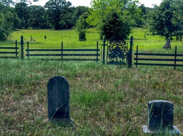
The image was in the real estate listing for the property. https://homelandprop.com/properties/1-10th-interest-lost-indian-lake-fishing-hunting-club/?fbclid=IwAR2RRXEe0cM-w2KNI1JWQsraKZVIIbhQ3or5EWMa-phBPgPSwNTOnAStlmE_aem_AasjpA73TNIQuE8U5p1yzIJXO9Mlk1Ow3oQ1FCQXLqnRfW_FllvYHcXjEKSOmcr61kv13v6eHq2GBbdqBvNzRItj
Creator: Photographer unknown. Date: Within the last two years.
The land at the confluence of Bedias Creek and the Trinity River has been a Bedias Indian settlement, Spanish garrison and bustling cotton plantation. Today it’s blanketed in forest, home to cattle and timber production, oil and gas wells, and state prison facilities. The story behind the transition is one of social, cultural, economic and technological change.
Today, the land at the confluence of Bedias Creek and the Trinity River is blanketed in forest, and dedicated largely to cattle and timber production, recreational use, oil and gas extraction, and state prison facilities, having transitioned from farming and sharecropping during the 20th Century. The story behind this transition is one of economic, social, cultural and technological change.
In his 1983 foundational book, Changes in the Land: Indians, Colonists and the Ecology of New England, environmental historian William Cronon theorized that studying the “role humans played in changing the land” on which they lived is as important as studying the lives of the people themselves. [1] As example, Cronon observed that significant changes to the land occurred because of the “shift from Indian to European dominance" beginning in the earliest days of the colonies. [2] These changes were driven largely by the transition to a mercantile economy, which favored property ownership and connected colonial goods to a European market. In studying the relationship between the ecological and social, or lifestyle, changes, Cronon concluded that most ecological change is driven by changing modes of economic production, and by social and cultural change. [3]
This certainly holds true in the Bedias Creek-Trinity River region in the present-day counties of Walker, Madison and Houston. Here,
the Bedias Indians lived for centuries, modifying the land they held collectively to support their hunter/gatherer lifestyle. They were eradicated by disease and European settlement, and then relocated to federal reservations. The Bedias population was supplanted by the Spanish garrison of Trinidad de Salcedo, followed by Anglo-American settlers, such as Samuel Calhoun, whose plantation economy was driven by slaves who became sharecroppers after the Civil War. The land was modified by each group as needed to support their means of economic production and by the ensuing social and cultural changes. [4]
The years following the Civil War also were marked by social, cultural, economic and technological changes that altered the land's use. By the 1880s, more than 60 percent of those operating farms in Walker County were tenants or sharecroppers, and many were former slaves. [5] Under the crop-lien system, they held no ownership and worked for a small share of the crop receipts. [6] Their plight was compounded by the boll weevil infestation of the early 1900’s, which caused a significant decline in cotton production. [7] By 1905, Texas newspapers reported that damaged crops were being abandoned. [8] By 1919, some East Texas cotton farmers had already turned their attention to oil, which had been discovered on several farms. [9] Cotton production gradually shifted to the Texas High Plains, where the boll weevil was more susceptible to cold temperatures. [10] The population continued to thin during World War I and the Great Depression, as low pay and fewer farm jobs led many to leave the area for higher paying manufacturing or industrial jobs. [11] The Depression significantly altered Walker County’s economy “as cotton farming collapsed, sharecroppers left the land and cattle ranching became more dominant.” [12] After World War II, the use of irrigation further shifted cotton production toward the High Plains and Rio Grande Valley. [13] By the 1970’s, cattle ranching had become the most profitable segment of Texas agriculture and cotton had all but disappeared from Walker County. [14]
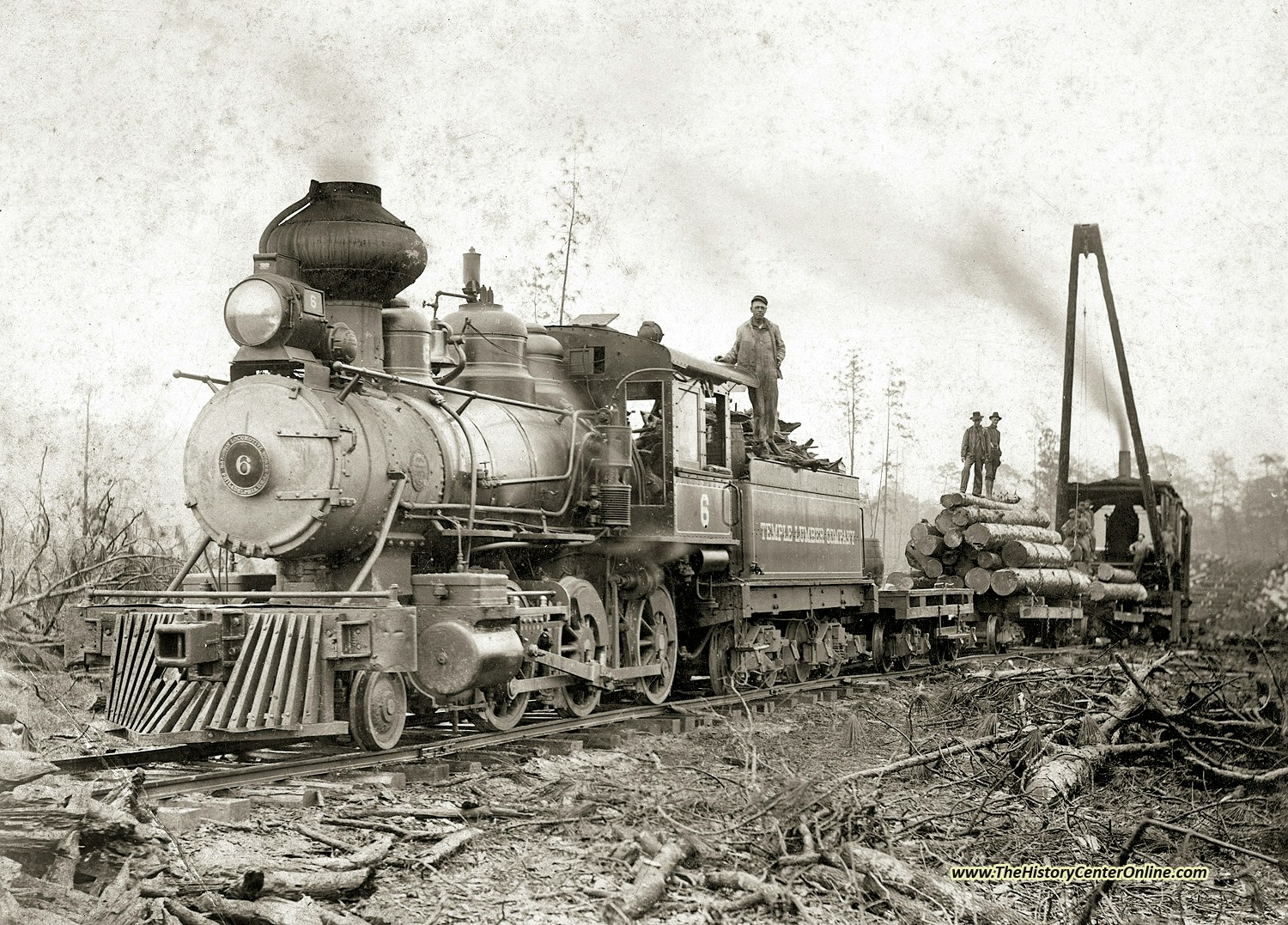
Commensurate with the decline of the region’s cotton growing era was the rise of its timber industry. The 1870’s brought the International and Great Southern Railroad, and its connection to the Houston and Great Northern Railroads enabled lumber and other finished products manufactured from Walker County timber to be transported to national and global markets, and provided employment to former sharecroppers. [15] During the Depression, four Texas National forests were created, and reforestation efforts led by the U.S. and Texas Forest Services helped sustain the industry. [16] In the 1940s, new uses were found for the region’s southern yellow pine, including the creation of newsprint from pulp and the invention of the log debarker, which enabled pine to be used for laminated beams, particle board and fiber board. [17] Today, the growing, harvesting and production of timber generates $41 billion for the Texas economy, much of which is centered in East Texas. [18] Texas timber is used for framing studs, plywood and two-by-fours for the home building industry, wood for furniture, and paper and cardboard. [19] As some 70 percent of Walker County land is covered in pine forest, lumber and forest products companies comprise a large percentage of the county’s economy, along with oil and gas production and the Texas prison system. [20]
After the Civil War, demand for petroleum products such as kerosene drove increased oil exploration as well. [21] The 1901 discovery of the Spindletop oil field on a Jefferson County salt dome launched Texas’ first oil boom and the “modern petroleum industry.” [22] An extensive pipeline system was built to transport oil from rural fields to refineries that were built along the Texas Gulf Coast. [23] This further expanded and diversified the region’s economy and provided jobs for former sharecroppers. [24] The discovery of natural gas in 1914 and subsequent construction of gas pipelines to refineries completed the shift from a farming to oil and gas economy. [25] During the Depression, the industry continued to build pipelines and refineries in support of the Gulf Coast’s fast growing petrochemical industry, and demand soared after WWII. [26] “Oil became the dominant commodity in the state” and cotton was no longer king.” [27] In the 1950’s, global demand for petrochemical products such as styrene, butadiene (used for synthetic rubber) and polypropylene (thermoplastic) further fueled the Texas oil and gas industry. [28] Texas now leads the nation in oil and gas production. [29] Today, more than 100 oil and gas wells dot Walker County, each well producing an average of 95 barrels of energy (BOE) per year. [30]
Prison facilities also dot the Trinity River region, stemming from the 1848 construction of the Texas State Penitentiary in nearby Huntsville. [31] Houston County's Wainright Unit, formerly named the Eastham Prison Farm, is a 12,979-acre unit housing 2,143 trustees engaged in farming and livestock operations. [32] Its existence also stems from the end of the plantation economy. In 1896, Mrs. D. Eastham paid the state (not the workers) $14.50 per month to use 119 convicts to work her 13,000-acre cotton plantation just west of the Trinity River in Houston County, many of them former sharecroppers. [33] In 1919, the plantation became a maximum-security prison. [34] Among its famous inmates is Clyde Barrow of Bonnie and Clyde fame, who was incarcerated at Eastham from April 1930 to May 1932 for car theft and burglary. [35] In January 1934, Barrow famously freed five of his gang members from Eastham during a violent breakout. [36] A smaller 4,355-acre prison unit was established in adjacent Madison County in 1935. Named the Jim Ferguson unit, it houses up to 2,096 inmates, also engaged in agriculture and livestock production. [37]
Other economic and technological changes impacted the use of the Trinity River waterway and the Bedias Creek watershed. When Samuel Calhoun and family arrived in northern Walker County in 1845, the plantation they and their slaves built at the confluence of Bedias Creek and the Trinity River also became a bustling riverport and ferry crossing. [38] With the passage of time, decline of cotton, and the construction of roads, bridges and railroads, the Calhoun Ferry eventually ceased operating. This likely occurred between 1922 and 1934, after Samuel Calhoun’s son and heir Louis moved to Houston and then sold the Walker County land near the river. A 1922 deed of sale suggests the ferry still may have been in operation, as Louis exempted “3 or 4 acres adjacent to the ferry” along the river from the sale. [39] In 1934, Louis conveyed most of the remaining acreage, but exempted a quarter-acre of the land “at the old ferry site” for the purpose of a new ferry landing, which suggests he had (unsuccessfully) hoped to rebuild it. [40] The importance of the Trinity River to commerce and transportation also declined with the advent of the railroad in the 1870s. Northern Walker County’s rural population continued to decline as agricultural workers left for lumber manufacturing jobs, and for oil and gas jobs in Houston and the Gulf Coast. In 1970, a dam was built across the main stem of Trinity River near Livingston, a joint project between the Trinity River Authority (TRA) and City of Houston to create large reservoir to supply water to the City of Houston, which owns 70 percent of the water supply. [41] The Livingston dam, which thus created Lake Livingston, made navigating the Trinity impossible and transformed the Bedias Creek watershed into a river and lake.[42] In 2021, the TRA and East Texas Electric Cooperative completed the construction of the R.C. Thomas Hydroelectric Project at the dam, which now provides 124-million kilowatt-hours of electricity per year to East Texas homes and businesses, and offsets 64,000 tons of carbon dioxide emissions from fossil fuels. [43]
Thus, the shift in land use from farming and sharecropping to cattle and timber, oil and gas extraction, prisons – and the damming of the Trinity River for water and hydroelectric power - were driven by economic, social and technological change. The region’s economic means of production were impacted by technological advancements that rendered the region less suitable for cotton and the river less important for commerce and transportation. At the same time, these changes enabled global market access for the region’s burgeoning cattle, timber, oil and gas sectors, and supplied water and electricity to East Texas’ growing urban population. Today, the land that once comprised Samuel Calhoun’s plantation is blanketed in forest, dotted with cattle and awash with lakes and tributaries, yet is lightly populated, with virtually nothing remaining of its long-ago Bedias Indian, Spanish and settler inhabitants.
Images
The image was in the real estate listing for the property. https://homelandprop.com/properties/1-10th-interest-lost-indian-lake-fishing-hunting-club/?fbclid=IwAR2RRXEe0cM-w2KNI1JWQsraKZVIIbhQ3or5EWMa-phBPgPSwNTOnAStlmE_aem_AasjpA73TNIQuE8U5p1yzIJXO9Mlk1Ow3oQ1FCQXLqnRfW_FllvYHcXjEKSOmcr61kv13v6eHq2GBbdqBvNzRItj
Creator: Photographer unknown. Date: Within the last two years.


TDCJ Connections Newsletter (texas.gov) Creator: Unknown. Date: Retrieved April 2024.


Date: 1962


Heritage Auctions website, accessed May 1, 2024. (Houston County / Madison County / Walker County), TX- Wyser and | Lot #96169 | Heritage Auctions (ha.com)
Creator: The note/ticket is part the Heritage Auctions' Powell Texas Currency Collection Part II. Date: The image was accessed on May 1, 2024