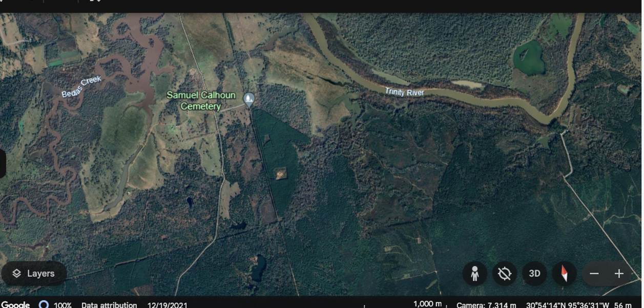
Aerial of the confluence of Bedias Creek and the Trinity River near the former Samuel Calhoun plantation. Lost Indian Lake can be seen near the bottom of the image, directly south of the Calhoun family cemetery.
An aerial image of Bedias Creek, the Trinity River and the Calhoun Cemetery, which was the site of the former Calhoun plantation. Once planted in cotton and corn, today the region is blanketed in pine forest and dotted with cattle. Lost Indian Lake, used for recreational purposes, can be seen at the bottom of the image, directly south of the Calhoun cemetery. | Creator: Google Earth | Date: Search conducted in April 2024. | Source: Google Earth. https://earth.google.com/web/@30.90588185,-95.60846329,48.62110874a,1668.52812105d,35y,14.28158518h,0t,0r/data=OgMKATA | Rights: Image available on the Internet and included for instructional purposes in accordance with Title 17 U.S.C. Section 107.Download Original File