Block 19, Houston: Lot Ownership by Pamelia Mann

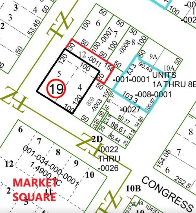
This map of Block 19 in Houston reveals more than lot lines and street addresses. The thick black and red markings trace the land owned by Pamelia Mann from 1837 until her death, connecting the past to the present site of Barnaby’s Café at 801 Congress Avenue. Each line and lot tells a story of early urban planning, ambition, and the strategies of a woman shaping her place in a growing city. By studying the map, viewers can imagine the transformation of Houston over nearly two centuries, from frontier plots to bustling streets, and wonder about the lives, decisions, and legacies hidden behind every boundary. | Creator: Harris County Appraisal District (Map 5457A2) | Date: Original land ownership: 1837–1840 (Pamelia Mann’s ownership); map created by Harris County Appraisal District, date of map unknown, accessed online 2026. | Source: Harris County Appraisal District property records and Map 5457A2, from which the lot boundaries and ownership information were derived. | Rights: © Harris County Appraisal District. Publicly available for reference and educational purposes; use beyond personal or educational purposes may require permission.
Download Original File