Filed Under Story

Historic American Buildings Survey of Freeman Plantation House

Earning about a dollar an hour, architects and draftsmen working for the Historic American Buildings Survey (HABS) painstakingly measured and sketched old structures like the William M. Freeman Plantation House. The National Park Service, which oversaw this New Deal initiative, directed that the workers be "selected on the basis of their ability" from the architects and draftsmen "on the unemployed rolls of the nearest Federal Reemployment Offices."

Each team or "squad" had two to eight members, depending on the size of the project and the "economy of transportation." The Dallas-based team that surveyed the Freeman Plantation House for two days in February 1934 included Charles B. Witchell, Robert H. Linskie and Hunter McKay, Jr. As the Squad Leader, Witchell earned $1.10 an hour while Linskie and McKay were each paid $.90 an hour. All worked a 30-hour week.

The District Officer could hire a professional photographer in lieu of one field position or have a squad member take photos. In East Texas, architectural teams used an existing staffer and Clarence Bulger, who worked with another squad, photographed the Freeman house in March with ten of his prints becoming part of the HABS record.

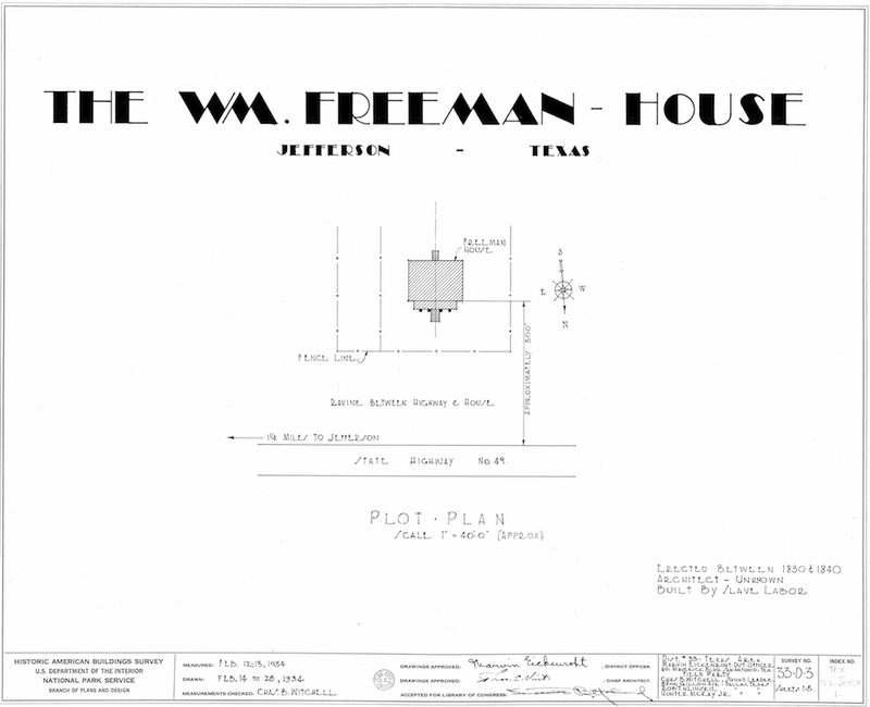
Although more commonly known as the William M. Freeman house, some of the HABS record identifies the property by the correct first name of the original owner, Williamson M. Freeman, a merchant and cotton planter. Located just west of the Jefferson city limits along Highway 49, the Freeman house was built in the early 1850s as the main home on Freeman's sugar and cotton plantation. An unknown architect designed the Louisiana raised cottage-type home which was constructed with slave labor. Witchell noted in the written history that "All brick was made and all lumber was cut on the property."

Freeman died in 1866 and the home was eventually sold outside the family. By the time the HABS team visited, Witchell stated that the house was in a "bad state of disrepair" but with "no evidence of any alterations or remodeling of consequence since the original construction."

Later owners restored it and in the mid-20th century, the Freeman home became a stop on the Jefferson Pilgrimage historic home tour as an example of 19th-century plantation life. In 1969 it was added to the National Register of Historic Places and in the early 1970s the Texas Society of the Daughters of the American Revolution owned it before the Jesse M. DeWare family acquired it. Today the Freeman Plantation House remains in the DeWare family.

Images

Freeman Plantation House from Northwest
Freeman Plantation House from Northwest Clarence Bulger, who usually worked with another HABS team, photographed the Williamson M. Freeman Plantation House, built in the early 1850s. This view from the northwest would be the first view someone driving onto the property would see today. Source: Historic American Buildings Survey, Library of Congress
Freeman Plantation House North Elevation
Freeman Plantation House North Elevation This view of the north or front elevation shows some of the house's Greek Revival elements, like a Doric tetrastyle portico, meaning it had four columns. Source: Historic American Buildings Survey, Library of Congress
Freeman Plantation House Entrance
Freeman Plantation House Entrance This photograph showing the front entrance provides the closest look at the plaster columns. A unidentified member of the survey team can be seen standing at the top of the stairs holding a foot rule for scale. Source: Historic American Buildings Survey, Library of Congress
Freeman Plantation House from Southwest
Freeman Plantation House from Southwest This view from the southwest shows the shallow hipped roof, deteriorating brickwork and a small structure behind the house. In addition to a man holding a survey tool, a unidentified child is seen at the top of the back steps. Creator: Historic American Buildings Survey, Library of Congress
Freeman Plantation House Measured Drawings Cover
Freeman Plantation House Measured Drawings Cover The survey team prepared this site plan as the cover for the measured drawings. Although it shows the construction date of the Freeman Plantation House as 1830 to 1840, the report states it was built about 1850. This plan also identifies the fence line seen in some photos and a ravine parallel to the highway which still exists. Source: Historic American Buildings Survey, Library of Congress
Freeman Plantation House Measured Drawing of Floor Plan
Freeman Plantation House Measured Drawing of Floor Plan Prepared by architect Charles B. Witchell, this measured drawing of the Freeman Plantation House floor plan shows the dimensions and types of rooms on both floors, as well as exterior features like stairs, porch and columns. It also shows what types of materials, like wood, brick and plaster, were used. Source: Historic American Buildings Survey, Library of Congress
Freeman Plantation House Measured Drawing of Details
Freeman Plantation House Measured Drawing of Details Hunter McKay, Jr., prepared two pages of measured drawings showing design details of key elements like the windows, doors and fireplace mantels. This page also shows the details of the center hallway arch and the stairway railing posts. Source: Historic American Buildings Survey, Library of Congress
Freeman Plantation House Measured Drawing of Elevations
Freeman Plantation House Measured Drawing of Elevations Robert H. Linskie created this measured drawing of the four elevations of the Freeman Plantation House. The dimensions show not only the height of stories and windows, but also the pitch of the roof. Source: Historic American Buildings Survey, Library of Congress

Location

Metadata

Amy Bertsch, “Historic American Buildings Survey of Freeman Plantation House,” East Texas History, accessed October 22, 2024, https://easttexashistory.org/items/show/90.